IMPACT MAPPING —
WHO? Car drivers both in urban and rural areas, [but primarily urban cities].
WHAT? Make it easier to search and pay for parking spots.
HOW
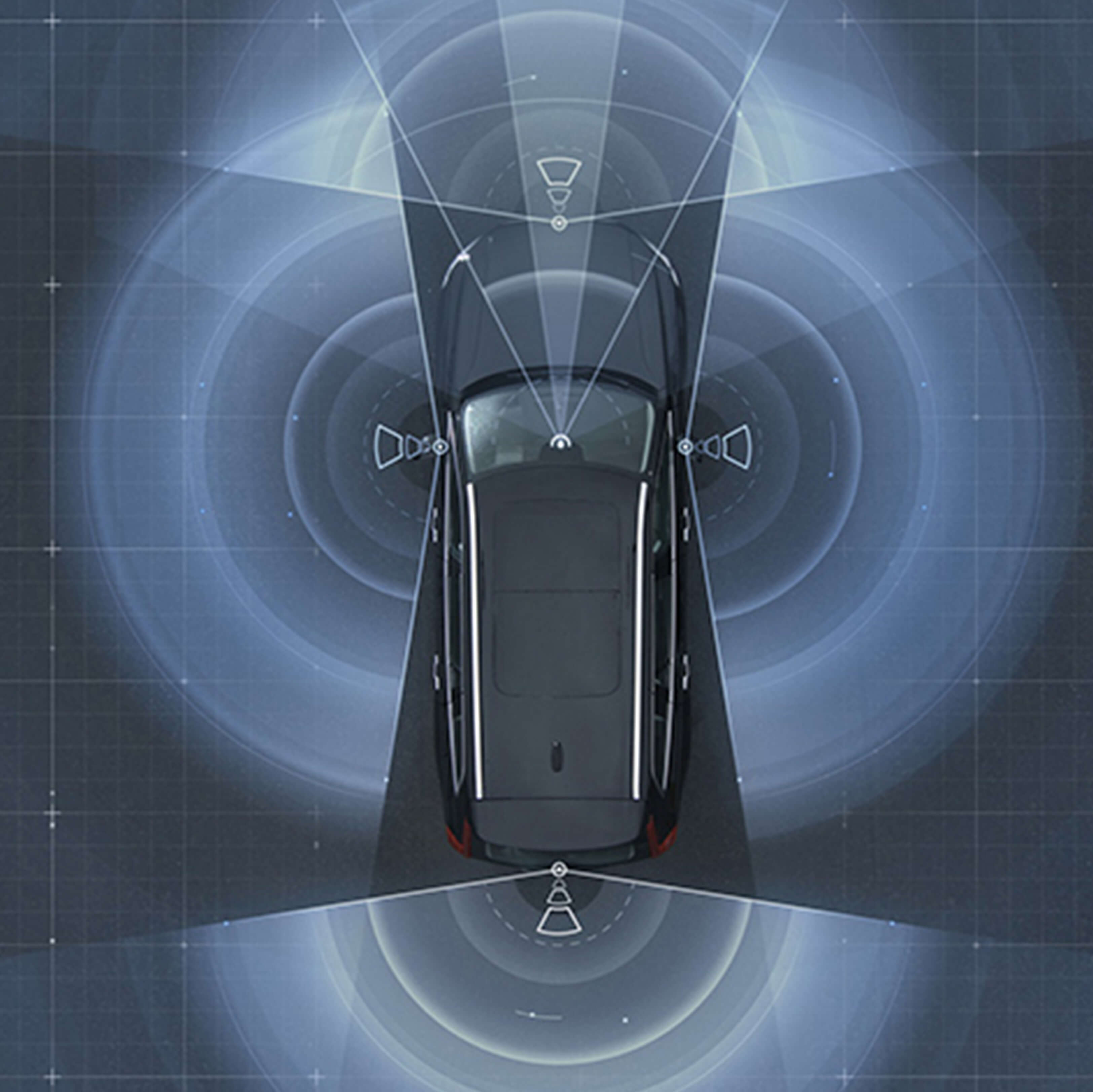
Using the data from radar and camera systems of Volvo cars on the road
Payment location using GPS to find relevant area
A pin dropped on a parked car
Notification updates about dated parking rules and registered tickets on the car
Easy access to parking rules